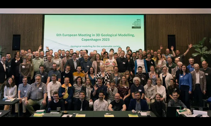
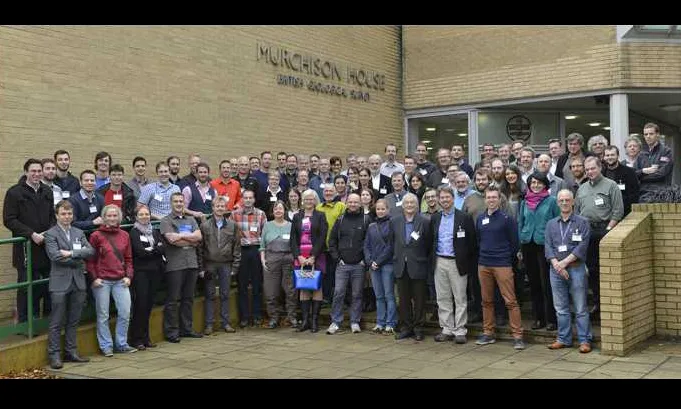
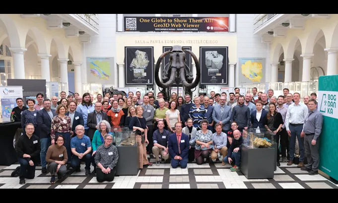
Meetings

For each of the meetings, the conference programme, abstracts, talks and other content has been made available to view and download, and this has been done with the permission of the authors.

Contributions to the 6th European meeting on 3D Geological Modelling   Copenhagen, Denmark. May 2023.

Host: The Geological Survey of Denmark and Greenland

Copenhagen 2023 group photo. BGS © UKRI.

Downloads

All abstracts pdf May 2023 | 1.03MB | .pdf

Country updates zip May 2023 | 344MB | .zip

Conference Proceedings and Administration zip May 2023 | 121MB | .zip

Poster abstracts

  1. 2D/3D cartographic display of data in Slovakia - Robert Cibula (pdf)
  2. 3D modelling of Eocene cly deposits near Friedland, NE Germany - K Obst (pdf)
  3. Case study at a model site "Green economy park" in Bremerhaven, Germany "Luneplate": High-resolution 3D subsurface models in flow modeling with focus on climate resilience" - Katherine Seiter (pdf)
  4. Current status of geoframework datasets and 3D databases at the Kentucky Geological Survey - William Andrews (pdf)
  5. Customization and implementation of a 3D data model viewer for dissemination, distribution, and reutilization of geological models at the Geological Survey of Catalonia (ICGC): use cases for geothermal energy - Ignasi Herms (pdf)
  6. Geological modelling of the near-surface in support of underground urban planning. Geological Survey of Sweden - Eva Wendelin (pdf)
  7. Loop: Probabilistic three dimensional geological modeling - Lachlan Grose (pdf)
  8. Modelling the base of Quaternary deposits in Northwest Germany - Cornelia Wangenheim (pdf)
  9. Open publication of the voxel model of the shallow subsurface of Antwerp for a sustainable development of the urban area - Katrien De Nil (pdf)
  10. Systematic modelling of the Jura fold-and-thrust belt (Switzerland): Aims, Methodology and current state of implementation - Eva Kurmann (pdf)
  11. The urgent need for better mapping, coordination and management of the shallow urban subsurface - Holger Kessler (pdf)
  12. Towards National Scale 3D Geological Modelling using an Implicit Deep Learning Method - Michael Hillier (pdf)
  13. Up-to-date, high-quality, policy-relevant subsurface geoscientific information can be fair? - Chiara D'Ambrogi (pdf)

Talks

Session 1 – Geomodelling of the near surface – towards a sustainable society

  1. Geological 3D modelling urban areas - Emilia Kosonen (pdf)
  2. UK urban subsurface research - Ricky Terrington (pdf)
  3. Near surface 3D modelling in urban areas - Rouwen Lehné (pdf)
  4. Antwerp's Shallow Subsurface Unlocking Its Potential for a Sustainable Future through Detailed Geological Study and Voxel Modeling - Tom Van Haren (pdf)
  5. Norway's potential in REE - Claudia Haase (pdf)
  6. Application of Random Forest Machine Learning for Regional 3D Hydrostratigraphic Modeling - Jesse Korus (pdf)
  7. Topsoil Groundwater salinization and management within climate change - Nico Deus (pdf)
  8. Modelling fast and slow - Jan Stafleu (pdf)
  9. H3O the legacy of a decade of cross border 3Dgeological modelling - Jan Walstra (pdf)

Session 2 Sustainability – Green Transition

  1. Mid-depth basin model for sustainable subsurface use: 500+ m thick salt. Legacy oil and gas. Hot-dry rock and geothermal resources in porous media all in one place - A case study from NW Poland - Ewa Szynkaruk (pdf)
  2. SEEMS DEEP geophysics based 3D geomodeling for mineral exploration - Suvi Heinonen (pdf)
  3. Making the Dutch 3D geomodels suitable for the energy transition - Johan Ten Veen (pdf)
  4. Construction of a provincial scale 3D geological model of the western canadian sedimentary basin in Saskatchewan Canada - Karine Bédard (pdf)

Session 3 - Model dissemination and data management

  1. 3D models as a bridge between science and policy - Abigail K Burt (pdf)
  2. GEUS 3D database present stage and what did we learn - Marianne B Wiese (pdf)
  3. 3D visualisation of groundwater quality and groundwater quality contributes to sustainable planning and protection of groundwater - Mariëlle van Vliet (pdf)
  4. Obtaining a social license for groundwater abstraction at Kurikka aquifer Finland using a community accessible hydrogeological data and software platform - Niko Putkinen (pdf)
  5. Heading towards integration of 3D data for municipalities geocim trial for Liberec city - Zita Bukovska (pdf)

Session 4 - Advances in research, trends and innovation in honour of Keith Turner

Keith Turner memorial presentation zip May 2023 | 149MB | .zip

  1. The importance of memory and listening to stories - Holger Kessler (pdf)
  2. From field data to 3D model of deep underground environment for future Deep Geological Repository - Ondřej Švagera (pdf)
  3. Uncertainty assessment of existing 3D geological models - Ingelise Mǿeller (pdf)
  4. Building on 50 years of geomodelling walking a tightrope between tradition and clean slate - Nicolas Clausolles (pdf)
  5. Structural modeling with geocognitive processes - Imadeddine Laoici (pdf)
  6. Making geoscience data and information more accessible in urban environments - Steve Thorpe (pdf)
  7. Advanced 3D geological modelling at SGU A virtual fly by of key mineral deposits in Sweden - Stefan Luth (pdf)

Software demonstrations

Includes:

The role of 3D geology in spatial planning  Bern, Switzerland. May 2019.

Host: The Swiss Geological Survey (Swisstopo)

Bern 2019 group photo. BGS © UKRI.

Downloads

Welcome addresses zip May 2019 | 11.1MB | .zip

Country updates zip May 2019 | 75.4MB | .zip

Talks

Day 1 Wednesday 22nd May 2019

  1. Introduction: Dr Olivier Lateltin (pdf)
  2. 3D Geological Modelling and Planning: Philip Mielke (pdf)
  3. Interest of accurate 3D geomodels for geotechnical projects and interoperability between geology and BIM: Jean–Marie Leonard (pdf)
  4. Digital twin: Buzz word or paradigm change for geological modelling?: François ROBIDA – BRGM (pdf)
  5. Automated interpretation of boreholes and CPT data: Denise Maljers, Jan Gunnink, Jan Stafleu and others (pdf)
  6. Automated workflows for the integration of regioal 3D–geological models: Dirix Katrijn, Deckers Jef, Hambsch Lorenz, Van Haren Tom, De Koninck Roel, Rombaut Bernd, De Nil Katrien (pdf)

Day 2 Thursday 23rd May 2019

Advances research software development
  1. 3D geological modelling of high–resolution geophysical data (tow–TEM): Kallesøe, A J and Sandersen, P B E, GEUS. Jørgensen, F, Central Denmark Region (PDF)Dr Olivier Lateltin (pdf)
  2. Delivering 3D models in country wide scale on the web: Paul Gabriel (pdf)
Data dissemination infrastructure management
  1. Build up of a 3D–Data Infrastructure: Robert Pamer(BayLfU), Iveta Atanasova, Johannes Goßmann, Elisabeth Lutterschmid, Stephan Sieblitz (pdf)
  2. GEUS’ 3D Geological Model Database v.1.0. Summary of what have we been working on and what have we accomplished: Christian Brogaard Pedersen, Master of Science in Geology & Geoscience (pdf)
  3. RESQML V2: A data exchange Standard for Earth–Model Description: Dr Jean François RAINAUD, Dr Beiting Zhu–COLAS (pdf)
  4. Artificial Intelligence – Facilitating data preparation for 3D geological modelling: Roland Baumberger (pdf)
  5. How to make 3D geological models FAIR – Metadata and the Semantic Web: Gerold W Diepolder (LfU) (pdf)
3D Geology Modelling Benefit Society Morning
  1. Extending the Geotop Voxel Model to the South–Eastern Netherlands: Jan Stafleu, Jan Hummelman, Renée de Bruijn, et al. (pdf)
  2. Some cross–border 3D geomodelling issues in the Netherlands and surrounding countries: Hans Doornenbal, TNO (pdf)
  3. 3D geological modelling in a seismic country: where are we now?: Chiara D’Ambrogi, ISPRA (pdf)
  4. 3D model of a geothermal reservoir in fractured crystalline rock: Sascha Görne, Federal Institute for Geosciences and Natural Resources (pdf)
  5. Shaky grounds - Building a 3D model for the new Earthquake Hazard Map of Germany: Stephan Steuer, Volker Lorenz, and Thomas Spies, BGR (pdf)
  6. Realising the benefits of 3D: Evolving demands for digital geoscience in the UK: Dr Katie Whitbread, Holger Kessler, and Helen Fallas, BGS (pdf)
  7. Applied Multidimensional Geological Modelling: Enabling the Sustainable Use of the Shallow Subsurface: Turner, A K, Kessler, H, and van der Meulen, M (pdf)
3D Geololgy Modelling Benefits Society Afternoon
  1. Geological tunnel-mapping using photogrammetry: Mont Terri rock laboratory, St-Ursanne, Switzerland (pdf)
  2. Developing a geo-observatory and 3D geological model to support subsurface heat recovery and storage: Patton, A, Farr, M, Boon, G J, et al. BGS (pdf)
  3. St. Gallen / GeoMol3D models: Bastien Delacou, Swisstopo (pdf)
  4. Geological Survey of Finland: Steps from seamless mapping towards a National Geological 3D-framework: Eeva-Liisa Laine, Heidi Laxström, and Jussi Ahonen, GTK (pdf)
  5. 3D model of Mecklenburg–Western Pomerania–challenges and benefit: Karsten Obst, Juliane Brandes, Sabine Matting, et al. Landesamt für Umwelt, Naturschutz und Geologie (pdf)
  6. Preliminary results on 3D geologic map of Slovakia: Ladislav, Vizi, Marián, Zlocha, Balász, Kronome, et al. (pdf)

Day 3 Friday 24th May 2019

Building Information Modelling (BIM)
  1. Geotechnical Data Standardization for BIM: Mickaël Beaufils, BRGM (pdf)
  2. Interest of accruate 3D geomodels for geotechnical projects and interoperability between geolgy and BIM: Jean–Marie Leonard, Beiting Zhu–Colas, and Jean–Francois Rainaud, EGIS (pdf)
  3. BIM and geological data at the Swiss Geological Survey, status and outlook: Philip Wehrens, Stefan Volken, Swissoppo (pdf)
5th Dimension Model Certainty Reliability
  1. Perfect partial uncertainties of Dutch geological models: Willem Dabekaussen, and Jan H Hummelman, TNO (pdf)
  2. Some thoughts on the visualization of 3D geological models and their uncertainty: Björn Zehner, BGR (pdf)
  3. Mapped vs. Simulated Uncertainty: Florian Wellmann, Elisa Heim, and Miguel de la Varga, RWTH Aachen University (pdf)
Closing
  1. If you want it, then it is not a fairy tale: Theodor Herzl (pdf)

Delivering subsurface models for societal challenges   Hotel Dupanloup, Orléans, France. February 2018.

Host: The French Geological Survey (BRGM)

Orléans 2018 group photo. BGS © UKRI.

Downloads

Programme pdf February 2018 | 508KB | .pdf

All abstracts pdf February 2018 | 34.3MB | .pdf

First circular pdf February 2018 | 676KB | .pdf

Session 1 Wednesday 14h00

  1. Introduction (pdf)
  2. Welcome (pdf)
  3. Country Overview Germany (pdf)
  4. Czech Geological Survey (pdf)
  5. Poland – country update (pdf)
  6. 3D Modelling at TNO (pdf)
  7. GeoMol Switzerland (pdf)
  8. Country update: Northern Belgium (Flanders) (pdf)

Session 2 Wednesday 16h10

  1. Visualisation of 3D/4D models in Geosciences - Network of infrastructure (NoI) (pdf)
  2. Towards a European Fault Database - TNO (pdf)
  3. Enhancing Science-Based Decision Making and Communication of Complex Geoscience Information to Stakeholdersx - Alberta Geological Survey (pdf)
  4. Geological Mapping in the USA - Minnesota Geologcial Survey (pdf)

Session 3 Thursday 08h30

  1. How Geological Architecture Helps 3D Modelling - Philippe Calcagno (pdf)
  2. Storing and delivering numerical geological models on demand - C Loiselet (pdf)
  3. Efficient management of 3D subsurface models and it's metadata - Paul Gabriel (pdf)
  4. Increasing the usability of 3D Geological models through applying user-centred design principles- Ane Bang-Kittilsen (pdf)
  5. Examples of how 3D models are used for protecting and managing groundwater resources - Eva Jirner (pdf)
  6. Advancements in cloud based visualisation of geological models - Holger Kessler and Holger Lipke (pdf)

Session 4 Thursday 10h30

  1. Vel‐IO 3D: a recipe for 3D management of velocity data and time‐depth conversion - C D'Ambrogi and F E Maesano (pdf)
  2. RESQML V2.2 How the Geomodeling Community can take benefit of this standard? - Dr Jean François Rainaud (pdf)
  3. Development of BGS Groundhog software with GTK - Ben Wood (BGS) – Niko Putkinen (GSF) (pdf)
  4. Increasing the usability of 3D Geological models through applying user-centred design principles- Ane Bang-Kittilsen (pdf)
  5. RINGMESH: An Open-source data model for Integrative Numerical Geology - Francois Bonneau (pdf)
  6. Probabilistic Geomodelling and Geological inference - Florian Wellmann (pdf)

Session 5 Thursday 13h30

  1. Overview of R&D on 3D Geological Modelling at BRGM - Gabriel Courrioux (pdf)
  2. Collaborative 3D modeling: Hidden Pitfalls - A case study from Switzerland - Robin Allenbach, Roland Baumberger, and Lance Reynolds (pdf)
  3. Framework for modelling national scale 3D geological models - Michael Hillier and Boyan Brodaric (GSC) (pdf)
  4. Visual KARSYS A web‐platform for the documentation of karst aquifers including online geological modelling - Ane Bang-Kittilsen (pdf)
  5. Bringing an outcrop back to the office: which methods and what to do with it? - Thomas Dewez (BRGM) (pdf)
  6. Digging into 3D geological models with cavity laser point coulds; A preliminary approach - Cécile Allanic et al (pdf)

Session 6 Friday 8h30

  1. The first step to a 3D model of the North German Basin - Stephan Steuer (pdf)
  2. 3D distribution of groundwater salinity as derived from airborne EM and a stochastic geological model - FRESHEM Zeeland project - Esther van Baaren et al (pdf)
  3. 3D geological modelling of a structurally complex area (Languedoc, South of France): A tool of improved contraints on buried karstified massifs - Eglantine HUSSON et al (pdf)
  4. Coupling of GeoModeller and FEFLOW: A case study - Tunisian groundwater challenges addressed - Helen Gibson et al (pdf)
  5. Geological modelling of the El Golfo multi-event landslide. The tsunamigenic potential of flank collapses in oceanic volcanic islands - Jesús García-Crespo (pdf)

Session 7 Friday 10h30

  1. The first step to a 3D model of the North German Basin - Stephan Steuer (pdf)
  2. 3D distribution of groundwater salinity as derived from airborne EM and a stochastic geological model - FRESHEM Zeeland project - Esther van Baaren et al (pdf)
  3. 3D geological modelling of a structurally complex area (Languedoc, South of France): A tool of improved contraints on buried karstified massifs - Eglantine HUSSON et al (pdf)
  4. The Use of 3D models to manage the groundwater resources of the Lower Greensand Group aquifer, Hertfordshire and North London, England - Catherine Cripps (pdf)
  5. 3D Geological reconstructions for the development of geothematic layers useful for urban planning: El Papiol case study (Barcelona Metropolitan Area) - Roser Pi and Miquel Vilà (ICGC) (pdf)
  6. Supporting BIM by integrated geological 3D-modeling of urban underground - casestudyDarmstadt (Hesse), Germany - Session Urban Geology - Rouwen Lehné (pdf)
  7. MINnD UC8: Underground Infrastructures - Mickaël Beaufils (BRGM) (pdf)

A field trip, followed by two days of talks, discussion, demonstrations and networking  Wiesbaden, Germany — June 2016.

Host: Geological Survey of Hesse (HLNUG)

Wiesbaden 2016 group photo. BGS © UKRI.

Downloads

Agenda pdf June 2016 | 304KB | .pdf

Welcome address pdf June 2016 | 1.85MB | .pdf

County updates zip June 2016 | 28.9MB | .zip

Talks

Session 1: Model storage management and delivery (versioning, metadata and quality, dissemination and visualization)

  1. Management of 3D Geological Modelsat the British Geological Survey - Ben Wood and Martin Nayembil (pdf)
  2. Versioning and data management in decades-lasting projects - Markus Hölzner and Christian Dresbach (pdf)
  3. 3D Regional geological modelling in Poland - Zbigniew Małolepszy et al (pdf)
  4. Using (hydro) geological models in the DOV web portal - Pieter De Graef (pdf)
  5. A conceptual model for 3d geological model data and testing capabilities in spatial databases - Marianne B Wiese and Christian Brogaard Pedersen (pdf)
  6. New applications and projects with GST - Gabriel (pdf)
  7. Data Management and Visualisation of 3D-Objects in the Geothermal Information System GeotIS - Thorsten Agemar et al (pdf)

Session 2: Model interoperability and standards (incl. data models, INSPIRE compliance and an update of relevant EU/trans-border initiatives)

  1. 3D Modelling based on 2D seismic data: application to a Belgium-Dutch cross-border hydrogeological project - Maryke den Dulk (pdf)
  2. The H30-Project: Closing the gap between our nationwide (hydro) geological models -Ronald Vernes et al (pdf)
  3. Collaborative 3D geological modelling – A review from Switzerland - Robin Allenbach and Roland Baumberger (pdf)
  4. Raising Multiscale 3D Geological Models Interoperability - C Loiselet et al (pdf)
  5. Opportunities for international / EU cooperation - TNO (pdf)

Session 3: Model use and applications (esp. cross-domain use cases eg. in the urban environment, BIM, groundwater and environmental management)

  1. Applying 3D Geological Modeling to Infrastructure Design - Alan Keith Turner and Holger Kessler (pdf)
  2. From data to 3D model – using AI for fast 3D geological modelling of AEM data - Torben Bach et al (pdf)
  3. The UK's 'National Geological Model' - Jon Ford (pdf)
  4. Status update on GeoTOP, a 3D voxel model of the Netherlands - Hein Raat (pdf)
  5. Need for flexible volume discretization of a 3D surface model - Ines Görz et al (pdf)
  6. A parameterised 3D-Structure-Model for the state of Bremen (Germany) - Ronald Vernes et al (pdf)
  7. Using 3D Geological modelling in civil industry - Tina Živec (pdf)
  8. Transboundary Geological 3D-Modelling - An insight into applied projects in Saxony - C Loiselet et al (pdf)
  9. 3D Geological Models - Applicationin water resource management and groundwater protection - Michael Howahr (pdf)
  10. A 3D-model of the Uppsala esker - Eva Jirner (pdf)
  11. GeoQuatb - Developing a system for the sustainable management, 3D modelling & application of Quaternary deposit data - Stefan Volken (pdf)

To exchange progress, problems and solutions in our common quest to understand and communicate the 3D composition and properties of the subsurface to support science-based decision making. Edinburgh, UK — November 2014.

Host: British Geological Survey

Edinburgh 2014 group photo. BGS © UKRI.

Downloads

Agenda pdf November 2014 | 2334KB | .pdf

Questionnaire sent to geological surveys:Sebastian Pfleiderer, and Holger Kessler, Austria GBA and BGS (PDF) pdf November 2014 | 266KB | .pdf

Talks

  1. 3D Norge: a new project to build a 3D bedrock map of Norway: Iain Henderson, and Bjørn Ove Grøtan, NGU (pdf) — abstract (pdf)
  2. 3D modeling of the Flemish subsurface using GOCAD: Stijn Bos, VITO Flemish Institute of Technological Research — abstract (pdf)
  3. Building a geological reference platform using sequence stratigraphy...: Bernard Bourgine, Éric Lasseur, Aurélien Leynet, et al. — abstract (pdf)
  4. 3D modelling at the Geological Survey of Finland (GTK): Laine, E, Pasanen, A, and 3D team, GTK — abstract (pdf)
  5. Subsurface geopotentials vs geological risks: enhancements from 3D model analysis: Chiara D'Ambrogi, and Francesco E Maesano, ISPRA — abstract (pdf)
  6. Progress in geomodelling at TNO: Michiel van der Meulen, TNO — abstract (pdf)
  7. GST Framework: storing, managing and delivering of 3D data: Jan Gietzel, GiGa Infosystems — abstract (pdf)
  8. The new oil — Profitable storage and usage of geological data: Salomè Michael, and Roland Baumberger [swisstopo] — abstract (pdf)
  9. Proposed book (Wiley) — Applied Multidimensional Geological Modelling...: Turner, A K [Colorado School of Mines & BGS] (pdf)
  10. Thirteen Years of Progress in 3-D Geologic Mapping: A View from North America:: Donald A Keefer [ISGS] — abstract (pdf)
  11. Situating Knowledge On The Landscape: Rob Harrap, Shaun O'Connor, Matthew Ondercin, et al. [Queens] Sylvie Daniel [Universite Laval] — abstract (pdf)
  12. Brandenburg 3D — a comprehensive 3D subsurface model, conception of an infrastructure node and a web applicatio: Maik Schilling, Andreas Simon, Christoph Jahnke, et al. [Landesamt für Bergbau, Geologie und Rohstoffe (LBGR)] — abstract (pdf)

Workshop on 3D geological modelling methodologies. Utrecht, Netherlands — September 2013

Host: TNO

Utrecht 2013 group photo. BGS © UKRI.

Downloads

Agenda pdf September 2013 | 4.74MB | .pdf

Welcome address:Sebastian Pfleiderer, and Holger Kessler, Austria GBA and BGS (PDF) pdf September 2013 | 5.95MB | .pdf

Talks

  1. An overview of activities in BGS: Andy Kingdon, BGS (pdf)
  2. Geological surveying in the Netherlands: trends and perspectives: Michiel J van der Meulen, TNO (pdf)
  3. Overview of 3D modelling in Germany: Bernd Linder, and Geologischer Dienst, NRW (pdf)
  4. 3D models of the deeper underground — Case studies in the German North Sea: Gesa Kuhlmann, Stephan Steuer, and GPDN-Team, BGR (pdf)
  5. Le Référentiel Géologique and 3D modelling: Gabalda, S, Courrioux, G, and Guillen, A, BRGM (pdf)
  6. Examples of hydrogeological and geological modelling from geophysical data: Flemming Jørgensen, GEUS (pdf)
  7. Geological modelling in Denmark — An overview: Peter B E Sandersen, Flemming Jørgensen, Richard Thomsen, et al. GEUS (pdf)